Dear Readers,
 Charles Hutchins Hapgood was the son of the journalists and authors Hutchins Hapgood (1869-1944) and Neith Boyce (1872-1951). He was born in New York City on May 17, 1904, and, along with his siblings Harry Boyce (1901-1918), Miriam (1906-1990), and Beatrix (1910-1994), was raised in the family’s homes in New York and Provincetown, Massachusetts. Hapgood attended the Scarborough School in Westchester County, New York, and then, like his father, earned two degrees at Harvard University: an A.B. (1929) and M.A. (1932). Staying on in Cambridge, he completed the course requirements for a history Ph.D. but not his dissertation. After holding an administrative job at the Provincetown Community Center, and wartime positions with the Office of Strategic Services and the American Red Cross in Washington, D.C., Hapgood began a twenty-year teaching career in the humanities through faculty appointments at Keystone College (1945-1947), Springfield College (1947-1952), Keene State College (1956-1966), and New England College (1966-1967), where he lectured in world and American history, anthropology, economics, and the history of science.

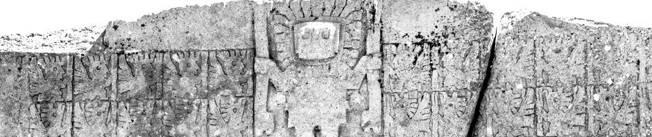
Throughout his academic career, as well as in his retirement years, Hapgood pursued personal research projects that centered on controversial, and largely disputed, topics. His first published work was The Earth’s Shifting Crust: a Key to Some Basic Problems of Earth Sciences (1958), which was revised and reissued in 1970 as The Path of the Pole. In these books he explored his theories about the movements of the outer layer of the earth and the resulting polar shifts, which he believed to have influenced the formation of various mountain ranges and the changing size and level of the oceans and seas. Hapgood’s follow-up work, Maps of the Ancient Sea Kings: Evidence of Advanced Civilization in the Ice Age (1966, revised edition 1979), suggested that Antarctica had been a habitable continent prior to the shift of the earth’s outer layer. His research was based in large part on a portolan chart drawn in 1513 by Piri Reis, a Turkish admiral and cartographer, which had been discovered in 1929 in an Istanbul library. Hapgood had earlier given a presentation on the map at the Tenth International Congress of the History of Science (Ithaca, New York, 1962). His continuing interest in ancient civilizations led to his publication Mystery in Acámbaro: an account of the ceramic collection of the late Waldemar Julsrud in Acámbaro, Gto., Mexico (1973), which discussed the more than 30,000 clay figures that had been excavated there in the summer of 1944; Hapgood supported Julsrud’s belief that the figures (representing humans from a variety of civilizations, as well as dinosaurs), which were found in near-perfect condition, had been created and buried several thousand years before. However, most academics believed them to be a hoax, and made for Julsrud by twentieth-century Mexican peasants. In addition to these works, Hapgood reached the general public through articles he wrote for the Saturday Evening Post and Coronet magazines, and with his book for children, Great Mysteries of the Earth, which was published in 1960; it was also issued in Arabic.
Concurrent with his investigations in the fields of earth science, ancient history, and archeology, Hapgood was actively interested in parapsychology and spirit communication. He spent a decade working with the New England medium Elwood Babbitt (1921-2001) to encounter nearly sixty notables in divinity and history, both recent and ancient. The conversations were taped and transcribed, and provided Hapgood with material for his final three books: Voices of Spirit, Through the Psychic Experience of Elwood Babbitt (1975), Talks with Christ and His Teachers Through the Psychic Gift of Elwood Babbitt (1981), and The God Within: a Testament of Vishnu, a Handbook for the Spiritual Renaissance (1982).
Charles Hapgood’s 1941 marriage to Tamsin Hughes (1906-1998) ended in divorce in 1955. In his later years he resided in Arizona and in Richmond, New Hampshire, but was living in Greenfield, Massachusetts, when he was struck by a car and died on December 21, 1982. Charles and Tamsin Hapgood were survived by two sons, Frederick (born 1942) and William (born 1944), and two grandsons.
This new entry on our blog hopes to give a view of what this American scientist theorized on. It is a compilation of information about it.
The Earth’s Shifting Crust theory
In 1958 Charles Hapgood suggested that the Earth’s crust had undergone repeated displacements and that the geological concepts of continental drift and sea-floor spreading owed their secondary livelihoods to the primary nature of crustal shift. Charles Hapgood suggested in his book The Earth’s Shifting Crust that the Earth’s crust had undergone repeated displacements and that the geological concepts of continental drift and sea-floor spreading owed their secondary livelihoods to the primary nature of crustal shift. According to Hapgood, crustal shift was made possible by a layer of liquid rock situated about 100 miles beneath the surface of the planet. A pole shift would thus displace the Earth’s crust in around the inner mantle, resulting in crustal rock’s being exposed to magnetic fields of a different direction.
While at Springfield College, a student’s question about the Lost Continent of Mu prompted a class project to investigate the lost continent of Atlantis, leading Hapgood to investigate possible ways that massive earth changes could occur and exposing him to the literature of Hugh Auchincloss Brown.
 In 1958, Hapgood published The Earth’s Shifting Crust, which denied the existence of continental drift and featured a foreword by Albert Einstein. In Maps of the Ancient Sea Kings (1966) and The Path of the Pole (1970), Hapgood proposed the hypothesis that the Earth’s axis has shifted numerous times during geological history. In Maps of the Ancient Sea Kings he supported the suggestion made by Arlington Mallery that a part of the Piri Reis Map was a depiction of the area of Antarctica known as Queen Maud Land. He used this to propose that a 15 degree pole shift occurred around 9,600 BCE (approx. 11,600 years ago) and that a part of the Antarctic was ice-free at that time, and that an ice-age civilization could have mapped the coast. He concludes that Antarctica was mapped when these parts were free of ice, taking that view that an Antarctic warm period coincided with the last ice age in the Northern hemisphere, and that the Piri Reis and other maps were based on «ancient» maps derived from ice-age originals. Later research concerning the paleoclimatology and ice sheets of Antarctica have completely discredited the interpretations by Hapgood that an Antarctic warm period coincided with the last glacial period in the Northern hemisphere and any part of it had been ice-free at and prior to 9,600 BCE (approx. 11,600 years ago).
Hapgood also examined a 1531 map by French mathematician and cartographer Oronce Finé (aka Oronteus Finaeus). In Maps of the Ancient Sea Kings, he reproduces letters that he states he received from the chief of a U.S. Air Force cartography section stationed at Westover AFB in 1961. These letters say that at Hapgood’s request, they had studied both Piri Reis and Oronce Finé maps during their off-duty hours, concluding that both were compiled from original source maps of Antarctica at a time when it was relatively free of ice, supporting Hapgood’s findings. Hapgood concluded that advanced cartographic knowledge appears on the Piri Reis map and the Oronteus Finaeus map, and must be the result of some unknown ancient civilization that developed advanced scientific knowledge before other civilizations such as Greece.

Map of Piri Reis
According to historians Paul Hoye and Paul Lunde, while Hapgood’s work garnered some enthusiasm and praise for its thoroughness, his revolutionary hypotheses largely met with skepticism and were ignored by most scholars. In the book The Piri Reis Map of 1513 Gregory C. McIntosh examines Hapgood’s claims for both maps and states that they fall short of proving or even strongly suggesting that the Piri Reis map and the Fine map depict the actual outline of Antarctica.
Hapgood’s unorthodox interpretations such as Earth Crustal Displacement were never accepted as valid competing scientific hypotheses, yet his ideas have found popularity in alternative circles. Librarians Rose and Rand Flem-Ath as well as author and former journalist Graham Hancock base portions of their works on Hapgood’s evidence for catastrophe at the end of the Last Glacial Maximum. Hapgood’s ideas also figure prominently in the 2009 sci-fi/disaster movie 2012.
Graham Hancock, a former correspondent for The Economist, revives Hapgood’s argument, presenting evidence in his book Fingerprints of the Gods that there did indeed exist an Atlantis, which was responsible for many of the unexplained connections between known ancient civilizations, such as the Egyptians, Sumerians, and Aztecs:
Although beyond the scope of this book, a detailed exposition of the earth-crust displacement theory is to be found in Rand and Rose Flem-Ath’s When the Sky Fell (published by Stoddart, Canada, 1995). As noted, this geological theory was formulated by Professor Charles Hapgood and supported by Albert Einstein. In brief, what it suggests is a complete slippage of our planet’s thirty-mile-thick lithosphere over its nearly 8000-mile-thick central core, forcing large parts of the western hemisphere southward towards the equator and thence towards the Antarctic Circle. This movement is not seen as taking place along a due north-south meridian but on a swivelling course—pivoting, as it were, around the central plains of what is now the United States.

The result is that the north-eastern segment of North America (in which the North Pole was formerly located in Hudson’s Bay) is dragged southwards out of the Arctic Circle and into more temperate latitudes while at the same time the north-western segment (Alaska and the Yukon) swivels northwards into the Arctic Circle along with large parts of northern Siberia. In the southern hemisphere, Hapgood’s model shows the landmass that we now call Antarctica, much of which was previously at temperate or even warm latitudes, being shifted in its entirety inside the Antarctic Circle. The overall movement is seen as having been in the region of 30 degrees (approximately 2000 miles) and as having been concentrated, in the main, between the years 14,500 BC and 12,500 BC—but with massive aftershocks on a planetary scale continuing at widely-separated intervals down to about 9500 BC.

Rand Flem-Ath
Moreover, as the millennia passed, the ruins left behind—the cities, the monuments, the great libraries, and the engineering works of the destroyed civilization—would have been ever more deeply buried beneath the mantle of ice. Little wonder, if the earth-crust displacement theory is correct, that all that can be found today, scattered around the world, are the tantalizing fingerprints of the gods.
These would be the traces, the echoes of the works and deeds, the much misunderstood teachings and the geometrical edifices left behind by the few survivors of Antarctica’s  former civilization who had made it across the turbulent oceans in great ships and settled themselves in faraway lands: in the Nile Valley, for example (or perhaps, first, around Lake Tana at the headwaters of the Blue Nile), and in the Valley of Mexico, and near Lake Titicaca in the Andes—and no doubt in several other places as well …
Here and there around the globe, in other words, the fingerprints of a lost civilization remain faintly visible. The body is out of sight, buried under two miles of Antarctic ice and almost as inaccessible to archaeologists as if it were located on the dark side of the moon.
former civilization who had made it across the turbulent oceans in great ships and settled themselves in faraway lands: in the Nile Valley, for example (or perhaps, first, around Lake Tana at the headwaters of the Blue Nile), and in the Valley of Mexico, and near Lake Titicaca in the Andes—and no doubt in several other places as well …
Here and there around the globe, in other words, the fingerprints of a lost civilization remain faintly visible. The body is out of sight, buried under two miles of Antarctic ice and almost as inaccessible to archaeologists as if it were located on the dark side of the moon.
 Is it a geophysical possibility or a geophysical impossibility that Antarctica, the world’s fifth-largest continent (with a surface area of almost six million square miles) could (a) previously have been located in a more temperate zone and (b) have been shifted out of that zone and into the Antarctic Circle within the last 20,000 years?

Great shape similarity of Antarctica without ice with Finnaeus map
According to Hapgood, crustal shift was made possible by a layer of liquid rock situated beneath the surface of the planet. A pole shift would thus displace the Earth’s crust in around the inner mantle, resulting in crustal rock’s being exposed to magnetic fields of a different direction. An earth crust displacement, as the words suggest, is a movement of the ENTIRE outer shell of the earth over its inner layers. If you remove the peel from an orange and then reattach it to the fruit you can visualize the possibility of the peel moving over the inner layers. The Earth’s crust, according to Charles Hapgood, can similarly change its position over the inner layers. When it does the globe experiences climatic change. The climatic zones (polar, temperate and tropical) remain the same because the sun still shines on the earth from the same angle in the sky. From the perspective of people on the earth at the time, it appears as the sky is falling. In reality it is the earth’s crust shifting to another location. Some land moves towards the tropics. Others shift, with the same movement, towards the poles. Yet others may escape such great changes in latitude. The consequence of such a movement of the entire outer shell of the earth is catastrophic. Throughout the world massive earthquakes shake the land and enormous tidal waves crash into and over the continental shelf. As the old ice caps leave the polar zones they melt, raising the ocean level higher and higher. Everywhere, and by whatever means, people seek higher ground to avoid an ocean in upheaval. Vavilov found a direct correlation between agricultural origins and lands more than 4,920 feet above sea level. Working on the assumption that the earth’s magnetic poles are usually close to the poles of rotation, Hapgood collected geomagnetic rock samples, finding evidence that the most recent earth crust displacement must have occurred between 17,000 to 12,000 years ago. The North Pole would have moved from the Hudson Bay area of northern Canada to it’s current place in the Arctic Ocean.
More recently, Langway and Hansen (1973) gathered climactic data pointing to a dramatic change in climate at 12,000 years ago. At that time, the Pleistocene extinctions, rising ocean levels, the close of the ice age, and the origins of agriculture all seem to coincide.
Earth Crust Displacement: Effects and Evidence
In his best-selling book Earth in Upheaval, historian Immanuel Velikovsky gave an account of what might be expected when the Earth tilts on it’s axis:
Let us assume, as a working hypothesis, that under the impact of a force or the influence of an agent – and the Earth does not travel in an empty universe – the axis of the earth shifted or tilted. At that moment an earthquake would make the globe shudder. Air and water would continue to move through inertia; hurricanes would sweep the Earth, and the seas would rush over continents, carrying gravel and sand and marine animals, and casting them onto land. Heat would be developed, rocks would melt, volcanoes would erupt, lava would flow from fissures in the ruptured ground and cover vast areas.
Mountains would spring up from the plains and would climb and travel upon the shoulders of other mountains, causing faults and rifts. Lakes would be tilted and emptied, rivers would change their beds; large land areas and all their inhabitants would slip under the sea. Forests would burn, and the hurricanes and wild seas would wrest them from the ground on which they grew and pile them, branch and root, in heaps. Seas would turn into deserts, their waters rolling away.

Piri Reis
And if the change in the velocity of the diurnal rotation [slowing the planet down] should accompany the shifting of the axis, the water confined to the equatorial oceans by centrifugal force would retreat to the poles, and high tides and hurricanes would rush from pole to pole, carrying reindeers and seals to the tropics and desert lions to the Arctic, moving from the equator up to the mountain ridges of the Himalayas and down the African jungles; and crumbled rocks torn from splintering mountains would be scattered over large distances; and herds of animals would be washed from the plains of Siberia.
The shifting of the axis would change the climate in every place, leaving corals in Newfoundland and elephants in Alaska, fig trees in northern Greenland and luxuriant forests in Antarctica. In the event of a rapid shift of the axis, many species and genera of animals on land and in the sea would be destroyed, and civilizations, if any, would be reduced to ruins.

Immanuel Velikovsky
Neither Hapgood nor Velikovsky were pulling theories out of the air. The theory that the terrestrial crust is swimming on magma was first offered in the 1850’s. The record of bones and trees, and shells and layers of sediment that had been found throughout the world pointed to one or more cataclysms in the Earth’s past, some of them as recently as 1,500 B.C.E. and amazingly, 800 B.C.E. Velikovsky sums up the scientific establishment’s past record on answering the questions:
What caused tropical forests to grow in polar regions? What caused volcanic activity on a great scale in the past and lava flows on land and in the ocean beds? What caused earthquakes to be so numerous and violent in the past? Puzzlement, despair, and frustration are the only answers to each and every one of these phenomena.

Antarctica without ice, and Lake Vostok
The theories of uniformity (or gradualism) and evolution maintain that the geological record bears witness that from time immemorial, even from the time this planet began it’s existence only minute changes – caused by the wind blowing on rocks, the sand grains swimming to the sea – accumulated into vast changes. These causes however, are inadequate to explain the great revolutions in nature, and they evoke the expressions of futility on the part of the specialists, each in his field. Velikovsky continues with his account:
… The evidence is overwhelming that the great global catastrophes were either accompanied or caused by shifting of the terrestrial axis or by a disturbance in the diurnal and annual motions of the Earth … The state of lavas with reversed magnetization, hundreds of times more intensive than the inverted terrestrial magnetic field could impart, reveals the nature of the forces that were in action …
 Many world-wide phenomena, for each of which the cause is vainly sought, are explained by a single cause: the sudden changes in climate, transgression of the sea, vast volcanic and seismic activities, formation of ice cover, pluvial crises, emergence of mountains and their dislocation, rising and subsidence of coasts, tilting of lakes, sedimentation, fossilization, the provenance of tropical animals and plants in polar regions, conglomerates of fossil animals of various latitudes and habitats, the extinction of species and genera, the appearance of new species, the reversal of the Earth’s magnetic field, and a score of other world-wide phenomena.

Oronteus Finnaeus
Look into any one of the above fields and you will begin to see the same pattern Velikovsky, Hapgood, Einstein and hundreds of other independent geologists, paleontologists and archeologists have recognized in the Earth’s past. A pattern of repeated, catastrophic change thought to be brought about by crustal displacements activated by one or more outside agents – such as passing comets or fluctuations in the sun’s own magnetic field – appears to have been with humanity and its civilizations from the very dawn of mankind. Rand and Rose Flem-Ath discussed earth-crust displacement’ in their book, When the Sky Fell. Seeing evidence of it in almost all parts of the world they described it’s effects and the consequences for mankind today. The displacement that happened, according to them at about 11,000 BC, had:
… also left other evidence of its deadly visit in a ring of death around the globe. All the continents that experience rapid and massive extinctions of animal species (notably the Americas and Siberia) underwent massive changes in their latitudes…
And coral has been found in Newfoundland, ferns, fossils, coal and fossilized tree-stumps have been found in Antarctica, water lilies and fossilized palm leaves ten and twelve feet long have been found in Spitzbergen, there is evidence that the swamp cypress flourished within 500 miles of the North Pole in the Miocene epoch, and more. The evidence is overwhelming that the Poles have not covered the same parts of the planet for the entire extent of our geological history. The consequences of the displacement are monumental.

The earth’s crust ripples over its interior and the world is shaken by incredible quakes and floods. They sky appears to fall as continents groan and shift position. Deep in the ocean, earthquakes generate massive tidal waves which crash against the coastlines, flooding them. Some lands shift to warmer climes, while others, propelled into polar zones, suffer the direst of winters. Melting ice caps raise the ocean’s level higher and higher. All living things must adapt, migrate or die … If the horror of an earth-crust displacement were to be visited upon today’s interdependent world the progress of thousands of years of civilization would be torn away from our planet like a fine cobweb. Those who live near high mountains might escape the global tidal waves, but they would be forced to leave behind, in the lowlands, the slowly constructed fruits of civilization.

Oronteus Finnaeus’ map
Only amongst the merchant marine and navies of the world might some evidence of civilization remain. The rusting hulls of ships and submarines would eventually perish but the valuable maps that are housed in them would be saved by survivors, perhaps for hundreds, even thousands of years. Until once again mankind could use them to sail the World Ocean in search of lost lands …
That something such as this could have happened to the earth seems, in our forward-looking culture of progress, somehow unbelievable. We are not taught such concepts at school nor are we brought up to think in this way. Suggesting that it could happen in the future can earn everything from the epithet of ‘prophet of doom’ to outright academic scorn. Nevertheless, look into the holy works and records of the ancient civilizations and you will find corroboration from what remains of the ‘media’ of their time, their mythology, legends and folklore. Cataclysmic events on a global scale did strike the civilizations of the ancients, and many recorded it in the clearest and most intelligible ways they were capable of at the time.
The accounts survive throughout the world to this day only as a number of so-called myths about earth-rending, global catastrophes.

Pingback: Antartica, Atlantis, and the Earth crustal displacement theory | canadanewslibre